Tauranga Visitor Information
New Zealand is one of the top holiday destinations in the world. Tauranga visitor information is helpful in planning travel around New Zealand. Tauranga tourist travel and visitor information may include immigration services, Internet cafes, destination information, national parks, tourism training, web cams and general New Zealand travel information. more
Tauranga I-SITE visitor information centres provide tourists and travellers with useful visitor information such as local activities and camping grounds.
Tauranga Visitor Information Directory
Select Tauranga Travel and Visitor Information from the list below. Alternatively select a different area.
Find By
Select by Category
-
FERGUSSON PARK - Tauranga, Matua
FERGUSSON PARK - Tauranga, Matua
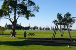
Fergusson Park is a dog-friendly playground for all. Coastal walkway with views across Tauranga harbour to Matakana Island and The Mount. Kiteboarding, paddleboarding, Tauranga Astronomical Society Observatory, children's play area. Limited free overnight parking for self contained campervans.
-
KAIATE FALLS - Welcome Bay, Tauranga
KAIATE FALLS - Welcome Bay, Tauranga
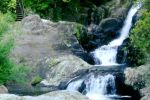
Bush walk and waterfall, just 15 minutes from Tauranga (off Welcome Bay Rd). The Kaiate Stream drops over bluffs in a series of waterfalls that plummet into clear pools. Moss and fern-fringed cliffs. A beautiful location to enjoy.
-
MCLAREN FALLS PARK - Kaimai Ranges, Tauranga
MCLAREN FALLS PARK - Kaimai Ranges, Tauranga
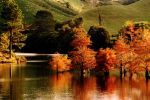
190 hectare parkland, exotic trees, waterfalls, walkways, cafe, kayaking, placid lake, equestrian area, camping, school camps, glow worms, bush walks. A photographer's paradise. McClaren Falls is in the Kaimai Ranges, just 15 minutes from Tauranga.
-
MOTURIKI, LEISURE ISLAND - Mount Maunganui
MOTURIKI, LEISURE ISLAND - Mount Maunganui
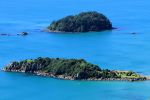
Moturiki Island | Leisure Island is a popular visitor attraction just off Mount Maunganui’s Main Beach. It's connected to the beach and you can simply walk across and enjoy the views, the crashing waves and watch the surfers just off the island.
-
PAPAMOA HILLS REGIONAL PARK - TE RAE O PAPAMOA, Tauranga, Te Puke
PAPAMOA HILLS REGIONAL PARK - TE RAE O PAPAMOA, Tauranga, Te Puke
45 minute hill climb through pine forest, native bush and farmland to reach the summit (224 metres) with panoramic coastal views, including The Mount (Mt Maunganui), Tauranga, Te Puke and towards Whakatane. At the summit is a former Maori pa site which, with terracing still visible, fires the imagination.
-
THE MOUNT, MAUAO - Mt Maunganui
THE MOUNT, MAUAO - Mt Maunganui
"The Mount" is New Zealand's most popular walk. It's estimated a million people walk up or around the mountain each year. On any given day you will encounter thousands of walkers, runners, parents with pushchairs, old, young - all simply enjoying this beautiful coastal walk / climb.
-
Tauranga Harbour, New Zealand - Web Cam
Tauranga Harbour, New Zealand - Web Cam
Tauranga Harbour is one of New Zealand's largest seaports. This webcam shows views of the North and South end of the wharf, as well as movements in the container terminal. Images update every 2 minutes.
Select by Map
This New Zealand map does not display any listings on the map itself but may provide navigation by clicking on map symbol. Alternatively select a category or a region from the main links to find and view tourism businesses.


